
Why?
With every other coverage prediction solution on the market, we ran into some combination of limitations:
- Only the most simple install methods supported
- Non-integrated with infrastructure hardware record systems
- Non-integrated with Customer record systems
- Very expensive
- Low resolution, using only categorical clutter heights not real-world LiDAR data
- Limited or no ability to do additional analysis
- Cumbersome for technical users to get work done
- Too complicated for non-technical users
So we decided to do it ourselves.
What We Made
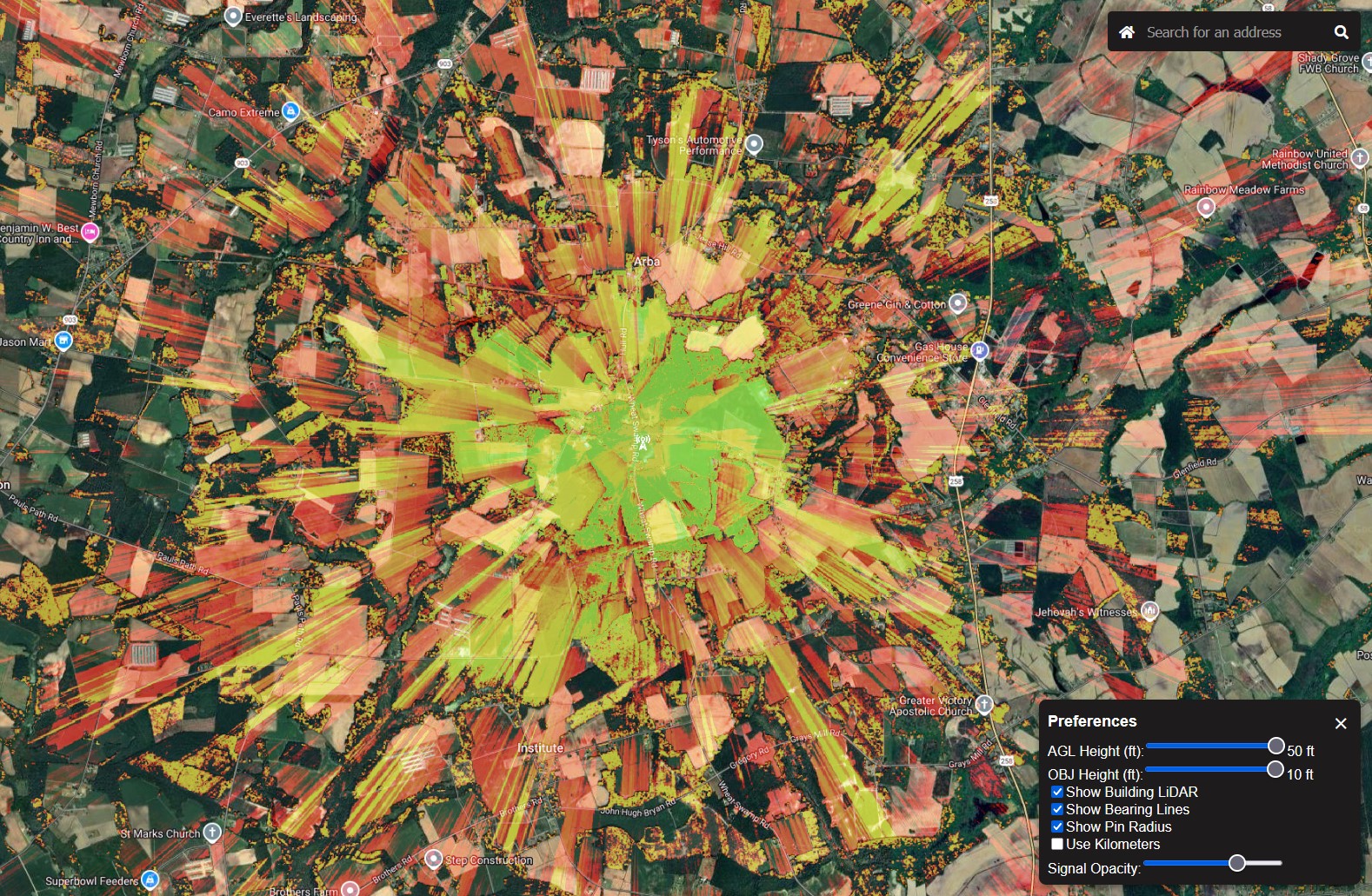
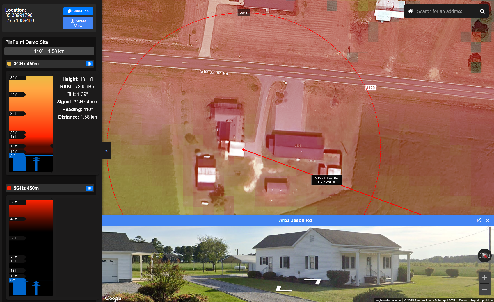
We generate high-precision, LiDAR-driven coverage predictions for every radio system on every tower, and present your team with an easy-to-use interface for quickly identifying good install locations.
- Check every radio system on every tower at once. No flipping between layers or maps.
- See the approximate object height (trees included).
- Find the clean sight-line shot for the best connection.
- Check streetview for any surprises
Be as creative as you can be to get that customer connected! We model every install method we’ve ever seen used:
- Eaves mount on primary building
- Non-Pen with or without extension pole
- On a remote building, either trench cabled or PtP
- Up in trees
- On a pole in the yard
When you find the placement you want, share a link with the exact location, technology and height, or grab a screen shot, add any other markup, and add it to the install ticket. Your installer will have everything they need for a fast install!
As a module for EngineRoom, PinPoint PreQual is always in-sync with your infrastructure data, automatically.
Contact us for a demo today!